would be a perfect candidate for improvement with your technique.
While nice to have, it's debatable whether or not this property is essential. Denoyer didn't seem to think it was. It's a pity that the projections that could most benefit from improving their depiction of Antarctica will have a large and sudden jump in the scale along the parallels at 60 S.Milo wrote: ↑Fri May 31, 2024 10:52 pm If you want everything to line up properly, though, you can't just arbitrarily make the cut at 60° and expect it to work. You have to pick the cutoff [and/or adapt the base projection] such that the lengths of the cutoff parallel on the cylindrical map and the azimuthal one are equal, and they connect smoothly.
Cool, nice! If we can get an optimized illustration spun up, I'd be happy to feature the Quad-Wagner Continental Composite as an example of "a modified Wagner VII developed by Quad with the Chalker-Denoyer modification". You make it, you describe the specs, you name it, I'll include it. (Is quad Savard? Savard = quad? Is that right?)
It's not essential, imo. It's essential to offer that option, but not use it every time. I'm opening with something along the lines of "Insets may be sized according to the purpose and desired functionality of the composite", then listing the range of sizing options to consider and what each achieves. It only needs to roll at a 1:1 for certain applications, like printing on a cup or making a dual-display clock.
Hmmm.
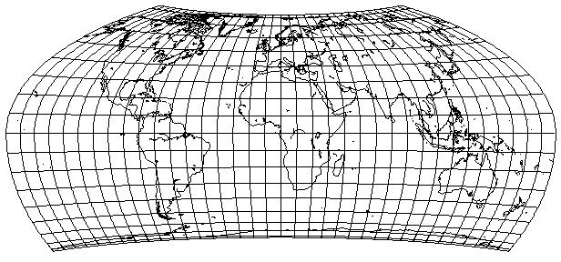
I understand what you mean. You need to be able to visualize the wrap, which is harder when the meridians don't match up. Aside from the meridians, though, I do think this is a visually nice-looking map (suitable for a classroom wall poster). I like that it shows the southern continents with less angular distortion than most other rounded maps I've seen. (That's why I use cylindrical from the equator down in my previous example, the Apian-Chalkerdome.) Maybe I'm biased bc I love the topology overlay, though. Beautiful, is that baked into the d3 starter kit or addon?Atarimaster wrote: ↑Mon Jun 10, 2024 7:09 am To me, this simply doesn’t work, not even in a artistic application. Because it feels like two unrelated maps – there is “no flow” (don’t know if it’s clear what I’m meaning here).
Code: Select all
//.attr("stroke", "black")
//.attr("stroke-width", "1px");Ah, got it! Finally figured out I can turn the borders off for compositing in Geocart, which is nice.Atarimaster wrote: ↑Mon Jun 10, 2024 11:32 am No, that image was composed in Geocart out two instances of the “generalized Wagner” and one of the azimuthal equal-area projection. But it should be able to do that in d3, as well.
No, you can't, because then you would double the scale along the meridians in the inset.
The closest projection that I know is the Baker dinomic, which uses the Mercator between 45° N and 45° S. There's also Györffy A, where the middle section looks cylindrical but isn't quite.