An Attractive Conventional Map

General discussion of map projections.
Post Reply
quadibloc
Posts: 292
Joined: Sun Aug 18, 2019 12:28 am

An Attractive Conventional Map

Post by quadibloc »

Although I have many other interests to pursue, and so haven't made updates to my map projection pages for a while, I now have added this image:
Image
which is at the bottom of the page
http://www.quadibloc.com/maps/mcv0603.htm
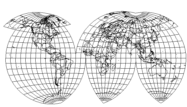
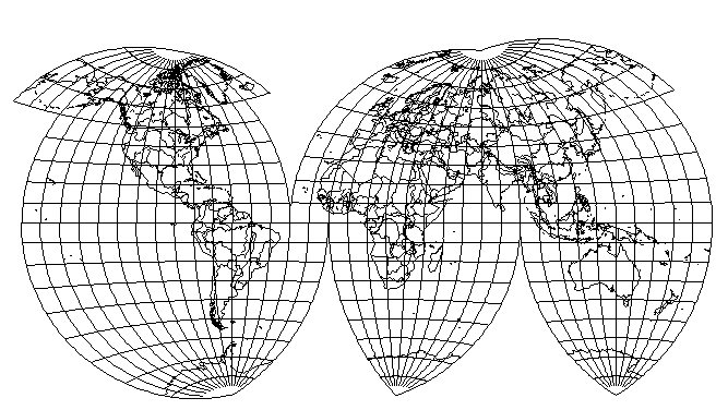
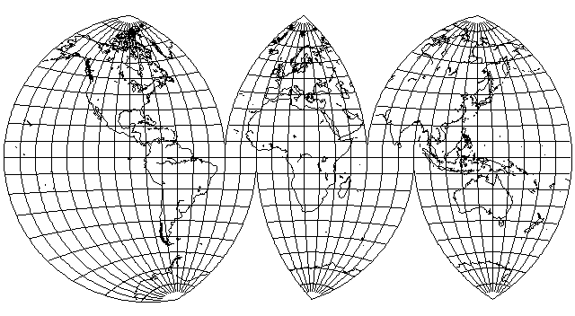
it is an interrupted modified Van der Grinten IV projection, where the projection distance is reduced from 180 degrees to 90 degrees, and thus, while this modification is less attractive as an uninterrupted world map, in the interrupted map, Alaska looks a lot better, indicating that shapes are being better preserved.
The Van der Grinten IV is a very unusual projection in that it can be interrupted even though as one goes away from the Equator, the parallels become curved. This is because they start becoming curved gently, so vertical scale along the Equator is uniform.
daan
Site Admin
Posts: 977
Joined: Sat Mar 28, 2009 11:17 pm

Re: An Attractive Conventional Map

Post by daan »

I didn’t realize the van der Grinten IV could be parameterized, having never really scrutinized the method. Thanks for the tutorial on your site. I agree that the 270° form is an improvement in the uninterrupted form. As far as interruptions go, I don’t like seeing Eurasia split up, so I would apply something else to the 90° form. Maybe something like this (using the original form). However, with the 11°E rotation, the western lobe should get shoved eastward so as not to slice into South America’s shoulder.
VdGIV.jpg
VdGIV.jpg (112.41 KiB) Viewed 7009 times
While it does bend Africa in a way that offends certain vociferous, no-longer-participating forum members, I prefer it to bisecting Eurasia.

— daan
Milo
Posts: 271
Joined: Fri Jan 22, 2021 11:11 am

Re: An Attractive Conventional Map

Post by Milo »

daan wrote: Sun Jun 02, 2024 8:11 pmWhile it does bend Africa in a way that offends certain vociferous, no-longer-participating forum members, I prefer it to bisecting Eurasia.
Is there a reason why you can't combine Quadibloc's interruptions for the southern hemisphere with your own interruptions for the northern hemisphere?

Although, I also dislike how close your northern interruption gets to the coast of South America. It's not crippling, but it still seems unnecessary.

In fact, aspects addressing both issues seem to already be present on Quadibloc's website:
Image
Image
(The "hanging extensions" are duplicates with parts of the world also shown elsewhere in the map - notice how Iceland appears twice, for example - so they can be safely ignored.)
quadibloc
Posts: 292
Joined: Sun Aug 18, 2019 12:28 am

Re: An Attractive Conventional Map

Post by quadibloc »

The reason I tend to prefer to bisect Eurasia is that I am, perhaps with malice aforethought (as there are those who could be offended by this), prioritizing areas of economic importance. So I put a standard meridian through North America close to the Eastern seaboard, one as close to the center of Western Europe as I need to (if I can afford to include Eastern Europe as well, as distortion remains low, I'll do so)... and for the Eastern lobe including part of Eurasia, I try to get the standard meridian as close to South Korea, Taiwan and Japan as I can.
In the Southern Hemisphere, usually the standard meridians are obvious, but in the case of Australia, I'm also choosing one close to the more populated Eastern coast.
Post Reply