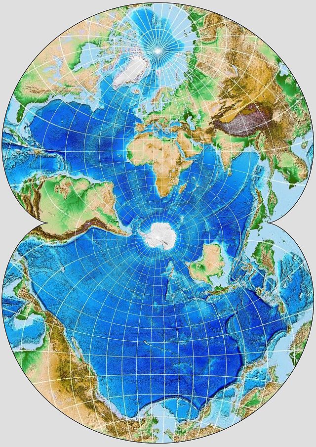
After once trying to create this kind of image for my web page, and failing, recently, I tried again, and this time my efforts were crowned with success.
Using a version of ETOPO as the base map, and first using "oblique equirectangular" to make the aspect, and then going from that output as input to make an August conformal progection on G_Projector, I've finally made a relief map in the projection and aspect used for Athelstan Spilhaus' famous world ocean map showing ocean currents.
Good job getting that figured out. I’m a little confused about the coastline overlay; is that something you can remove?
The aliasing in your image is pretty intense because of the way you arrive at the output. If you prefer an antialiased version, here is Geocart’s output:
Spilhaus ETOPO30.jpg
I don’t have access to my library right not, so I’m not certain my parameterization is correct, but anyway, in spherical manipulations to specify the projection center, I use 70°S as latitudinal shift, 15°E as longitudinal, and 90° as transversal.
— daan
You do not have the required permissions to view the files attached to this post.
Oops! I didn't notice the white coastlines, they were so inconspicuous. Fortunately, the hard part was making the oblique equirectangular map correctly. Re-doing the last step with the coastlines as well as the graticules turned off will be easy.
It's fixed now:
Hmm, that's odd. Is the old version cached somehow?
EDIT: Apologies: I corrected the errors that others cited on my web site, so the illustration in my initial post no longer matches the comments. I tried using the Attachments feature to put the original image in this post, but for some reason that is not working for me.