quadibloc wrote: ↑Thu Dec 17, 2020 8:36 pmmy guess would be that if you took the formula used for that image, and changed it as follows:
(…)
Thank you, but the problem has already been solved. I guess I didn’t report that, sorry.
By the way, did you notice that Frančula XII and XIII are quite similar to one of your own projections you showed at your
Ginzburg page? (The second to last image on that page.)
And – off-topic in this thread, but I’d like to mention it anyway –, on your
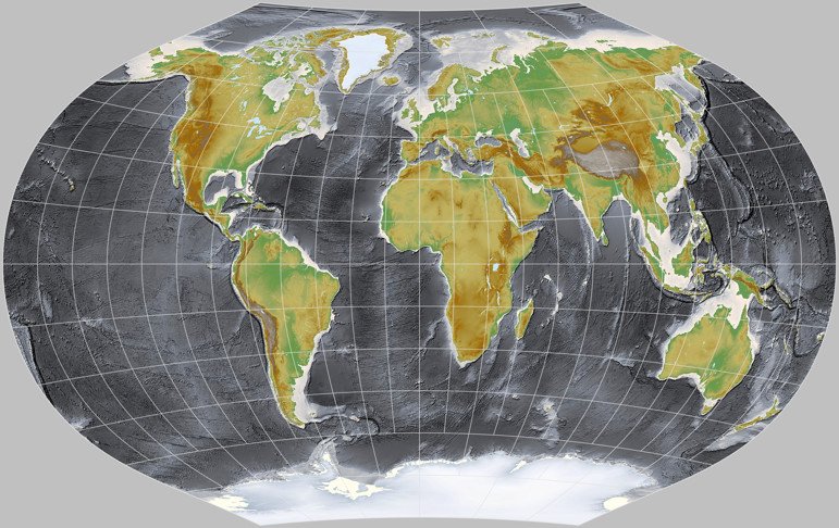
August Conformal page, I recently saw you using the NOAA “Topography and Bathymetry“ dataset. I instantly liked the black/dark grey oceans but I was not so fond of the way the continents look. So I modified one of my own elevation maps to have oceans in the same style.
Here’s my current result, projected to Ginzburg V:

- ginzburg-5-blackocean.jpg (117.58 KiB) Viewed 2487 times
It’s not exactly what I had in mind (I still might work a bit on the colors used on land), but it was close enough for me to use it in my 2021 map projection calendar.
By using the NOAA image on your website, you gave me the idea. So thank you!