What is extruded globe?

General discussion of map projections.
daan
Site Admin
Posts: 977
Joined: Sat Mar 28, 2009 11:17 pm

Re: What is extruded globe?

Post by daan »

quadibloc wrote: Fri Mar 27, 2020 1:09 pmIn the case of the Nicolosi Globular, the extension of the projection beyond a single hemisphere is obvious and well-behaved. And it is even occasionally used: i.e. if 20 degrees W and 160 degrees E are the boundaries, one might extend the Eastern hemisphere to show the extra bit of Eurasia.
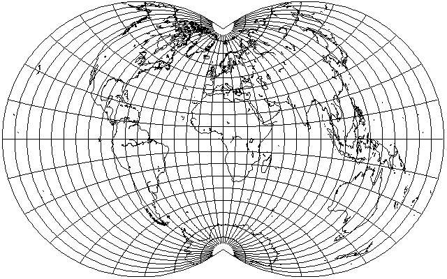
It isn’t obvious to me, given how it is formulated. It’s not simply λ × f(φ) the way most extensible equatorial projections are; the hemispheric boundary is singular under its general formulation; and I have to use complicated, bivariate series expansions very near the hemispheric boundary. I have no reason to doubt you, but I also have had no reason to look into the matter, having never been exposed to an extended Nicolosi, that I am aware of.

I’m sure some of Geocart’s hundreds of projections could be more general than normally formulated, while others might already more general than needed for typical use. It might be helpful to provide a default hemispheric boundary for the extruded globe projection, but I also think anyone using it for its literal purpose has a lot more to consider than a simple boundary setting. Actual globe makers have requested to set a bleed extending beyond the hemisphere; how much they need depends on their processes, not on arbitrary limits I might set. Anyone who isn’t making a globe probably shouldn’t be too concerned that there’s more than needed for making a globe; for them, it’s just another one of endless azimuthal projections.

Your point about naming is salient. Geocart isn’t consistent in how it treats the name of a projection that it implements more generally than the inventor described. I don’t have good answers for some of this stuff.

— daan
quadibloc
Posts: 292
Joined: Sun Aug 18, 2019 12:28 am

Re: What is extruded globe?

Post by quadibloc »

Here is the Nicolosi globular generalized to the world:
Image
Divide the bounding circle of the interior hemisphere into equal parts.
Divide the equator into equal parts.
Divide the central meridian into equal parts.
Then the longitude lines are circular arcs drawn that include the poles and the points on the Equator.
The latitude lines are circular arcs drawn from the points on the central meridian to the points on the bounding circle of the central hemisphere.
This is why I said it was obvious: I worked from the pencil-and-paper construction of the projection.
Piotr
Posts: 313
Joined: Thu Mar 23, 2017 12:27 pm

Re: What is extruded globe?

Post by Piotr »

Not to mention, https://mapthematics.com/ProjectionsLis ... 20globular states the following:

"Distortion

Moderate for a hemisphere
Considerable area and shape distortion if used beyond the 90th meridians"

Which suggests that Nicolosi globular is defined beyond a hemisphere, even though Geocart doesn't allow this (the feature request to allow this is Reveal).

Also, speaking of restrictions, uhh...

"Semimajor axis must be greater than or equal to semiminor axis." (ellipsoid in datum)
You literally made a picture on Wikipedia on unusual flattening of an ellipsoid, https://commons.wikimedia.org/wiki/File ... hed_SW.JPG . So couldn't users also go in the reverse direction and make a reverse ellipsoid?

"Legal values for P are between 0.0 and 1.0" (blending)
Why not linear extrapolation as well? If it fails then it will display a notice of incompatibility as it already does. If it succeeds then the user gets an extrapolated projection.

Also, another arbitrary thing is that the parameters are spaced every 10 degrees. If the user has more precise data then the user can't type it all out. If the user has less precise data then the user can't figure out what exactly to type in. If the user has that one bit of data that determines the spacing of bleed then it isn't available. And so on.
daan
Site Admin
Posts: 977
Joined: Sat Mar 28, 2009 11:17 pm

Re: What is extruded globe?

Post by daan »

Piotr wrote: Sat Mar 28, 2020 4:37 am Not to mention, https://mapthematics.com/ProjectionsLis ... 20globular states the following:

"Distortion

Moderate for a hemisphere
Considerable area and shape distortion if used beyond the 90th meridians"

Which suggests that Nicolosi globular is defined beyond a hemisphere…
That’s taken directly from Snyder, as attributed at the bottom of the page. I hadn’t noticed it. I might revisit this, although my interest will wane if the vicinity of the outer meridian proves as mathematically problematic as the 90°th meridians.
Also, speaking of restrictions, uhh...

"Semimajor axis must be greater than or equal to semiminor axis." (ellipsoid in datum)
You literally made a picture on Wikipedia on unusual flattening of an ellipsoid, https://commons.wikimedia.org/wiki/File ... hed_SW.JPG . So couldn't users also go in the reverse direction and make a reverse ellipsoid?
I think you refer to a prolate ellipsoid there. That’s mathematically possible, but my investigations into prolate ellipsoids—at least as far as the transverse Mercator go—did not suggest that much of the mathematics or programming for oblate would transfer over to prolate. These are computationally very difficult projections. Given how rare the need for prolate models, I have not pursued the matter.
"Legal values for P are between 0.0 and 1.0" (blending)
Why not linear extrapolation as well? If it fails then it will display a notice of incompatibility as it already does. If it succeeds then the user gets an extrapolated projection.
I like the idea, but it rarely works out in practice. Bilinear interpolation already gives no guarantees of a bijective result; extrapolation deteriorates much more rapidly. I would prefer to improve interpolation first. Then, perhaps, I would give thought to extrapolation.
Also, another arbitrary thing is that the parameters are spaced every 10 degrees. If the user has more precise data then the user can't type it all out. If the user has less precise data then the user can't figure out what exactly to type in. If the user has that one bit of data that determines the spacing of bleed then it isn't available. And so on.
Globe makers have experience with their materials. The 5° spacing appears to be as accurate as their processes can use, and I set the parameter count according to their requests. (Geocart 3.0 used 10° spacing, but this was increased to 5° in 3.1 directly due to customer requests.) Globe makers don’t have some fixed number of measurements that they use for all time and that are difficult to obtain. They update those measurements anytime their process changes (e.g., new batch of mylar, adjustment to heated temperature, change to cool-down time…) and seem satisfied to provide whatever number of measurements gives sufficient accuracy.

The distortion properties of the bleed are not relevant; it is only there to fill in gaps caused by imprecision in the physical process.

— daan
daan
Site Admin
Posts: 977
Joined: Sat Mar 28, 2009 11:17 pm

Re: What is extruded globe?

Post by daan »

quadibloc wrote: Sat Mar 28, 2020 12:57 am Here is the Nicolosi globular generalized to the world:
Image
I am surprised this hasn’t seen more use.

I might have a map from the mid 1800s on this projection. It’s something similar and I never identified the projection. Now I just have to find the thing…

— daan
daan
Site Admin
Posts: 977
Joined: Sat Mar 28, 2009 11:17 pm

Re: What is extruded globe?

Post by daan »

daan wrote: Wed Apr 01, 2020 10:26 pm I might have a map from the mid 1800s on this projection. It’s something similar and I never identified the projection. Now I just have to find the thing…
— daan
Definitely not Fournier or Nicolosi. I think I already determined that long ago, when I bought it.
Griswold 1843
Griswold 1843
IMG_0274 copy.jpg (82.55 KiB) Viewed 2025 times
— daan
quadibloc
Posts: 292
Joined: Sun Aug 18, 2019 12:28 am

Re: What is extruded globe?

Post by quadibloc »

It is indeed definitely not the Fournier I globular. Also, it's definitely not the Van der Grinten IV (which wouldn't have been invented yet, anyways).

It looks a lot like the Nicolosi, however, although Australia would have been more distorted on that projection. Given how old the map is, with incomplete coastline data, I'd be unsure, but I presume you took measurements that eliminated the Nicolosi.

It most closely resembles, of the projections I know about, the one by Henri Bouthillier de Beaumont, where the parallels are arcs equally separated at the central meridian and and the perimiter of the whole world. However, while that projection would have less extreme stretching at the edges than the Nicolosi, it still seems to have a bit more than this projection does, and I don't think the one by Bouthillier was invented then either.

EDIT: I examined it more closely, and it definitely is not Bouthillier's projection either. I did some searching online; I could not find the map you had, but I found another antique map that resembled it that was offered for sale - and I was able to find that map in an atlas on Google Books, "Atlas Designed to Illustrate the Malte-Brun School Geography". Comparing that map to yours, they seem to be in the same projection, if in one case there was an error in drawing one of the parallels.
Malte-Brun_Atlantic_enh.jpg
Malte-Brun_Atlantic_enh.jpg (180.18 KiB) Viewed 1926 times
I searched for more information, and could not find anything else that might lead me to the projection used. However, in looking for other old maps, I did come across something interesting on the Library of Congress web site that I did not expect to: an image of the gores used to make the 50-inch globe used by Franklin D. Roosevelt during World War II.

https://www.loc.gov/item/76694920/
quadibloc
Posts: 292
Joined: Sun Aug 18, 2019 12:28 am

Re: What is extruded globe?

Post by quadibloc »

Since I couldn't find any information about the scheme of projection that was used in these maps, I thought I would take a wild guess.

If someone in those days were seeking to create a projection that was very easy to draw, and which was, sort of, a mean between Nicolosi's globular projection, and Apian's globular projection, how would they do it?

Here is my answer:
hunt4.gif
hunt4.gif (16.33 KiB) Viewed 1923 times
Essentially: the meridian lines are constructed as in the Nicolosi globular projection.

The arcs for the parallels are drawn through equally spaced points on the central meridian, and points on the bounding circle of the inner hemisphere which are, on that circle, halfway between the equally-divided points of the Nicolosi globular, and the points which are on the level of the point at the central meridian as in the Apian.

However, when I compared my guess with your map, I found my guess was wrong. But when I compared your map, my guess, and the Nicolosi globular, I found that your map's parallels were halfway between those of my guess and those of the Nicolosi globular. So I revised my guess to be three parts Nicolosi to one part Apian, and I got this:
hunt6.gif
hunt6.gif (16.77 KiB) Viewed 1922 times
While close, however, it doesn't seem to be an exact match, so the actual projection appears to have been based on a somewhat different principle.
daan
Site Admin
Posts: 977
Joined: Sat Mar 28, 2009 11:17 pm

Re: What is extruded globe?

Post by daan »

Nice find on the globe gores! I’m surprised about how spare the color and content are. I suppose you’d want plenty of room for annotations, and no clutter.

I like the practical direction your explorations took for the map projection and I am a little surprised they didn’t pan out.

My map is 1843, by Samuel Griswold Goodrich. Goodrich was a prolific publisher of educational books, chiefly for children. I don’t know which of his many geographies this map is from despite perusing many on Google books, but it turns out that one of his publications is titled A System of School Geography Chiefly Derived from Malte-Brun. (But it doesn’t seem to have had any maps!) This association explains how it is that they came to use the same projection.

Cheers.
— daan
quadibloc
Posts: 292
Joined: Sun Aug 18, 2019 12:28 am

Re: What is extruded globe?

Post by quadibloc »

daan wrote: Tue Aug 18, 2020 5:34 pmI am a little surprised they didn’t pan out.
Actually, I'm not too certain, one way or another. I might even have hit the nail on the head, or the projection may be different from what I thought it was.
The example I found differs from your map, but when I had superimposed the two in a paint program, after matching their size, some parallels matched and others didn't. So if both maps were intended to have the same projection, but there was some allowance for imperfection in drawing them, my hypothesis might be within that tolerance.
At the moment, I'm uncertain in which direction to go to pursue this further. Possibly, for example, careful measurements might suggest a different guess at the drawing principle used. But it might not be too much to expect that, while my attempts to find more information in Google Books, the Internet Archives, and Google Patents weren't successful, that a description of the projection might exist in the rare books room of some college library on paper. (I also tried looking through my copy of Flattening the Earth.)
The atlas where I found my Atlantic Ocean map also has a similar one of the Pacific Ocean, and I've found another atlas with a map of the Pacific (which refers to its islands as Oceanica) that appears similar, but I haven't begun comparisons with those at this point.
EDIT: The maps of the Pacific may look similar, but unlike the maps of the Atlantic, the meridians don't coincide, so the projection is no longer a modified globular projection in the sense I was thinking of. So I only have the two maps of the Atlantic to go on.
Post Reply