These days, though, due to the strong emphasis on making maps equal-area, except for the maps of the whole world, most atlases today use the Lambert Azimuthal Equal-Area projection for every single map.
This isn't necessarily a bad thing, as it lets maps be compared. Older atlases might use a hodge-podge of projections based on whatever is easiest to draw. So an atlas might show Europe and Canada on the simple conic projection, the United States on the polyconic (!), Russia on Bonne's projection, and so on and so forth.
But the Lambert Azimuthal Equal-Area is a good choice for an area equal in height and width, roughly like a circle or a square. Not all maps are of areas of such shapes.
So if one is preparing a map of an area that is twice as wide as it is long, why not use the central part of a Hammer-Aitoff projection?
And as a recent thread here showed, instead of squeezing longitude by 2 and then stretching the x-axis by 2, one could use other factors as well, thus creating equal-area projections suitable for areas with other elongations.
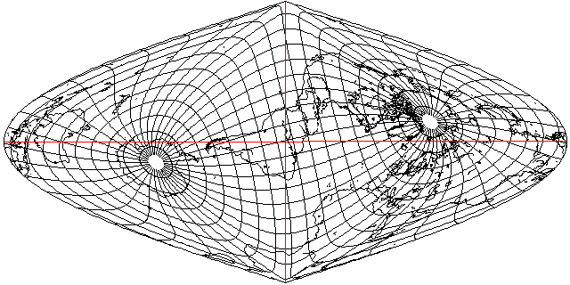
It occured to me that South America has a funny shape which lends itself well to the characteristics of the Sinusoidal projection, like this:

in case one is wondering, first I select the meridian of 32 degrees East longitude, tilt the globe forwards by 77 degrees, and assign the meridian to 95 degrees East on the map.
Africa also has an L-shape, but in its case, what to do is more simple and obvious.