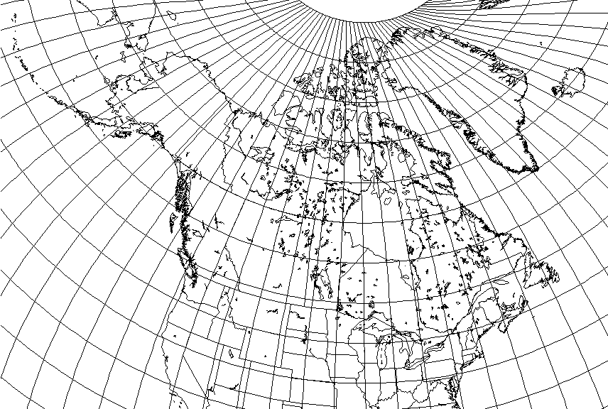
All it is, is a map of Canada on an interrupted Bonne's projection, with its standard parallel and standard meridians north and south of that standard parallel chosen so as to minimize distortion in Canada's most populated areas.
So the standard parallel is 50 degrees North.
The standard meridian north of the standard parallel is 110 degrees West, placing it between Edmonton and Saskatoon, the only major cities significantly north of that standard parallel.
Of Canada's three largest cities, Toronto, Vancouver, and Montreal, Vancouver is very close to the standard parallel, while Toronto and Montreal, fairly close together, are well south of it. So the standard meridian south of the standard parallel is 76 degrees West, lying neatly between them.
While it almost seems the obvious way to draw an equal-area map of Canada, to call attention to Canada's somewhat lopsided distribution of population so blatantly is generally not done in polite company.
I suppose that while it isn't really suited to, say, a relief map of Canada showing its geology, a map showing Canada's major rail lines and highways would be one that this projection would actually make sense for.