I like your asymmetric Wagner VII, too!
Here’s an approximation, created in Geocart.
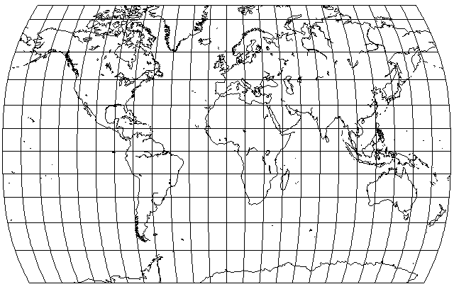
I rendered the two hemispheres separately and put them back together. Since I couldn’t quite figure out the parameters to be used in Geocart, I approached your version visually, which included a different amount of (non-equal-area) stretching for northern and southern hemisphere. So it’s definitely not the real thing but especially at this size, close enough to get a good impression.
Questions about optmization for equal-area world maps
-
Atarimaster
- Posts: 458
- Joined: Fri Nov 07, 2014 2:43 am
Re: Questions about optmization for equal-area world maps
You do not have the required permissions to view the files attached to this post.
-
quadibloc
- Posts: 338
- Joined: Sun Aug 18, 2019 12:28 am
Re: Questions about optmization for equal-area world maps
I'm glad you liked my projection, but of course credit for the idea goes to Daniel Strebe. Of course the two halves, in addition to having the same vertical scale at the equator, in order to match, which can include some stretching, would have individual stretching to compensate for the steps in making them. If you have to specify extra stretching by specifying a standard parallel, of course, then the math gets really hairy; then, make the maps to a large scale with the equator as a standard parallel, and do the final stretch in a paint program. Although I suspect Geocart doesn't leave too many useful features out.
-
Atarimaster
- Posts: 458
- Joined: Fri Nov 07, 2014 2:43 am
Re: Questions about optmization for equal-area world maps
Well, at least I’ve found values to avoid the non-equal-area stretching. Probably doesn’t match yours to a 100%, too…
For the northern hemisphere, the Geocart parameters are
Southern hemisphere:
No need to post another image, it looks almost like the one above.
For the northern hemisphere, the Geocart parameters are
Code: Select all
a = 2.8765
b = 1.133
m = 0.9205
m₂ = 1.0
n = 0.3333
Code: Select all
a = 2.8765
b = 1.7382
m = 0.6018
m₂ = 1.0
n = 0.3333
-
quadibloc
- Posts: 338
- Joined: Sun Aug 18, 2019 12:28 am
Re: Questions about optmization for equal-area world maps
I thought you had visually matched the Northern and Southern hemispheres so closely that there was probably not much area discrepancy.Atarimaster wrote:No need to post another image, it looks almost like the one above.
-
quadibloc
- Posts: 338
- Joined: Sun Aug 18, 2019 12:28 am
Re: Questions about optmization for equal-area world maps
The same is true of Guy Bomford's Modified Gall projection: I've attempted to improve on Snyder's recreation, with the following:daan wrote:I don’t have a useful copy of an original Denoyer map to compare against. I think everybody but you uses Snyder’s recreation. I’m confused by your description of Snyder’s as looking like Ortelius oval though: If anything, I’d say yours is more in the direction of Ortelius, but neither is close.
Here, the fault I find in Snyder's recreation is that it uses only a fourth-power term in the latitude to get the shortening, so that near the equator, the meridians look like straight lines, even at the map border. I've seen that projection in Oxford atlases, and there is still noticeable curvature on the Equator. I have just recieved an Oxford atlas today, so I've adjusted the parameters based on measurements to improve the resemblance.
I don't doubt John P. Snyder's abilities, but given the importance of his duties, it is at least possible that he gave only limited attention to the problem of reverse-engineering these map projections having no particular properties - and, therefore, being of not that much particular importance either.
-
daan
- Site Admin
- Posts: 1022
- Joined: Sat Mar 28, 2009 11:17 pm
Re: Questions about optmization for equal-area world maps
I presume the same. I get the impression he conjectured the construction method (often in drafting terms) and worked out the algebraic equivalent. If that did not match perfectly, and he didn’t synthesize any better conjectures, then he let it go because the approximation was not really his purpose. Still, approximations would be useful for characterizing the projection’s distortion, even if only loosely, and so that is why he published them.quadibloc wrote:I don't doubt John P. Snyder's abilities, but given the importance of his duties, it is at least possible that he gave only limited attention to the problem of reverse-engineering these map projections having no particular properties - and, therefore, being of not that much particular importance either.
— daan
-
quadibloc
- Posts: 338
- Joined: Sun Aug 18, 2019 12:28 am
Re: Questions about optmization for equal-area world maps
Which is all fine and dandy. But since his approximations are misused in programs like G.Projector (and your own Geocart, I presume) to draw likenesses of the projections, while I haven't aimed at a perfect replica either, I've gone another step in making the approximation at least resemble the original in appearance in terms of its obvious characteristics.daan wrote:I presume the same. I get the impression he conjectured the construction method (often in drafting terms) and worked out the algebraic equivalent. If that did not match perfectly, and he didn’t synthesize any better conjectures, then he let it go because the approximation was not really his purpose. Still, approximations would be useful for characterizing the projection’s distortion, even if only loosely, and so that is why he published them.
In Flattening the Earth, Snyder gives his formula for the width scale in this projection as 1 - .04 ϕ[sup]4[/sup], where phi is the latitude in radians. My formula is simply 1 - .0186 ϕ[sup]2[/sup] - .03 ϕ[sup]4[/sup], with the coefficients rounded off a bit (I calculated my formula for the latitude in degrees instead). The result looks visibly curved, instead of visibly flat, in the tropical regions, like the real thing. (I found it on the Web only once, in a listing on an eBay like site in Latin America, but now I have an Oxford atlas in my collection again.)
With the Denoyer Semi-Elliptical, I used a fairly complicated technique for my approximation, one I'm not sure I'd recommend to anyone else. If I find better source images to work from, I might investigate what Snyder's approximation was, and whether I can achieve what I want through extending it in a simple fashion.
For a program that purports to draw these projections, even if only approximately, major features of the projection obvious to even the untrained eye shouldn't be left out.