As I noted in another posting here, I have developed a method for blending equal-area projections, yielding equal-area results.
Here is a sample sequence, and here is higher resolution.
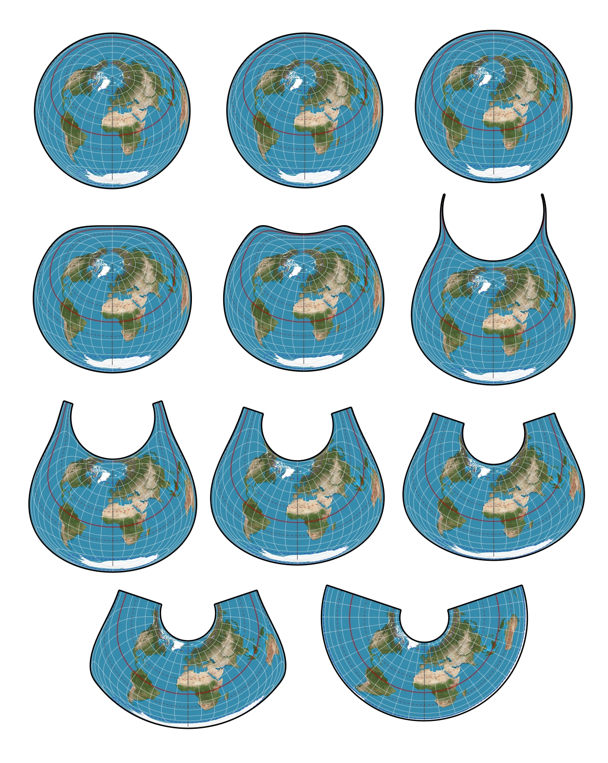
Notice that the topologies of the first and final projections are distinct. The blending still works fine. Determing the outer boundary isn’t trivial when the topologies differ.
The first projection in Lambert azimuthal equal-area centered at 37°4′24″. The last is Albers with standard parallels of 29°30′ and 45°30′.
Enjoy!
— daan
Blended equal-area projections
-
daan
- Site Admin
- Posts: 1022
- Joined: Sat Mar 28, 2009 11:17 pm
Blended equal-area projections
You do not have the required permissions to view the files attached to this post.
-
Atarimaster
- Posts: 457
- Joined: Fri Nov 07, 2014 2:43 am
Re: Blended equal-area projections
This really looks interesting!
Thanks for sharing, I’m looking forward to try it in Geocart.
Kind regards,
Tobias
Thanks for sharing, I’m looking forward to try it in Geocart.
Kind regards,
Tobias
-
daan
- Site Admin
- Posts: 1022
- Joined: Sat Mar 28, 2009 11:17 pm
Re: Blended equal-area projections
See the pretty videos.
— daan
-
daan
- Site Admin
- Posts: 1022
- Joined: Sat Mar 28, 2009 11:17 pm
Re: Blended equal-area projections
Actually, you already can. See the diagram of the method here:Atarimaster wrote:This really looks interesting!
Thanks for sharing, I’m looking forward to try it in Geocart.
Kind regards,
Tobias
https://www.mapthematics.com/Downloads/Progression.png
You have projections A and B and you want a projection somewhere between them, with k being the “distance” between A and B, and 0 ≤ k ≤ 1.
- Project to A. Use high resolution inversely proportional to k. If k < ½, consider going from B to A instead.
- Scale projected A by k.
- Export your k∙A projection as a TIFF image, preserving the high resolution.
- Place the k∙A image on a new document.
- Make a new map A at the original scale. Center A on k∙A.
- Export the map as a reprojection database.
- Make a new map in projection B. Add the reprojection database, and turn off the graticule and outer boundaries.
- Scale the new map by 1/k.
It’s a manually intensive process, but you can experiment to heart’s content. Let me know if you need more information on how to do this.
Best,
— daan
-
daan
- Site Admin
- Posts: 1022
- Joined: Sat Mar 28, 2009 11:17 pm
Re: Blended equal-area projections
The peer-reviewed paper is now published online in Cartography and Geographic Information Science. You can acquire the Author's Manuscript here. The Version of Record is here. The print edition will come out in a few months.
Cheers!
— daan
Cheers!
— daan